Best Foot Forward: The Bridestone Rocks from Lydgate


Distance: Five miles (8km)
Minimum time: 2hrs 30min
Ascent/gradient: 984ft (300m)
Level of difficulty: Medium
Paths: Moorland and packhorse paths, some quiet oads, three stiles
Landscape: Steep-sided valley and open moorland
Parking: Roadside parking in Lydgate, 1.5 miles (2.4km) out of Todmorden, on A646, signposted to Burnley
From the post office in Lydgate, take Church Road.
At the end go right, down the drive towards a house.
Advertisement
Hide AdAdvertisement
Hide AdLook immediately for a path that passes to the right of this house and soon goes beneath the arch of a railway viaduct.
Join a stony track, as you walk steeply uphill, the track is sunken, between walls.
Where the walls end, the track gives access to open moorland.
Keep right, along a track towards a farm.
Keep left of the farmhouse, continuing along a walled track uphill.
Advertisement
Hide AdAdvertisement
Hide AdWhen you meet another walled track, go right towards a rocky outcrop on the first horizon.

Beyond two gates you are on open moorland again: Whirlaw Common.
Cross pasture on a section of paved causeway to arrive, via a gate, at Whirlaw Stones.
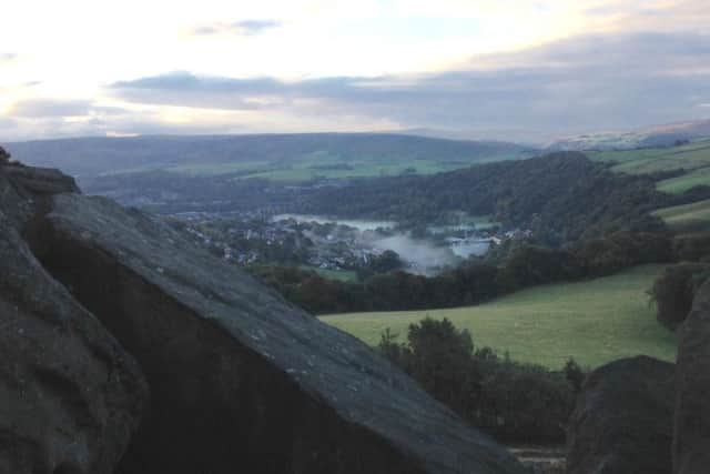
Keep to the causeway that bears right, below the stones, with panoramic views of the Cliviger Valley, Todmorden and, ahead, Stoodley Pike.
Leave Whirlaw Common by a gate on to a walled path.
Advertisement
Hide AdAdvertisement
Hide AdBear sharp left at a farm, on a stony track that follows a wall uphill.
Bear right around the rocks, to join Windy Harbour Lane.
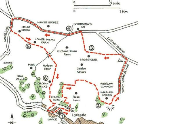
You have a steep climb, before the road levels off to meet Eastwood Road.
Go left here for just 150yds (140m). Where the wall ends, take a stile on the left.
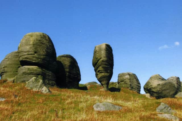
A grassy path leads you to another fascinating collection of rocks, known as the Bridestones.
Advertisement
Hide AdAdvertisement
Hide AdContinue past the Bridestones through a landscape of scattered boulders, before turning right to follow an indistinct path across rough terrain.
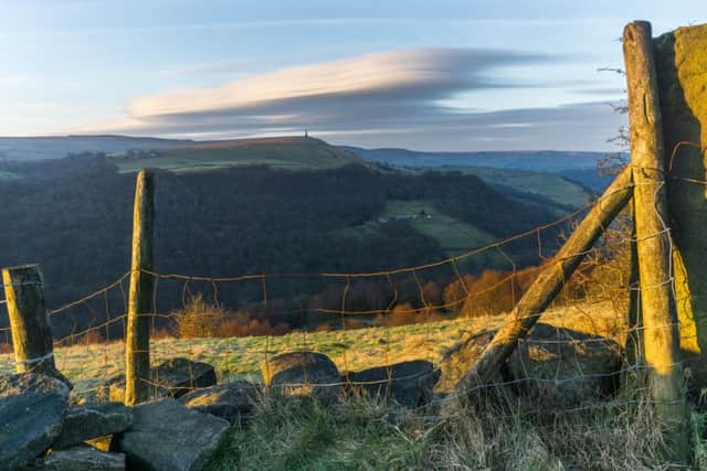
When you meet a road, you’ll be greeted by the sight of the Sportsman’s Inn.
Go left, along the road; you have a mile (1.6km) of level walking, passing the Hawks Stones on the right and a handful of houses, until you come to a minor
road on the left.
This is Mount Lane, signed to Shore and Todmorden. Walk down this road and beyond a farm on the right, take a good track to the left, slightly downhill.
Look out for Mount Cross in a field to your left.
Advertisement
Hide AdAdvertisement
Hide AdDetour past Lower Intake Farm on a path, soon enclosed by walls. 200yds (183m) beyond a small bridge over a stream, look out for a stile on your right, by
a gate between heavy stone gateposts.
Follow a field path downhill, keeping a wall to your left.
This grassy track takes you beneath another gritstone outcrop, known as Orchan Rocks.
Where the wall bears left, beyond the rocks, follow it downhill to a stile.
You now join a farm track that takes a serpentine route downill, through woodland.
Your way is clear: down into the valley and back into Lydgate.