Best Foot Forward: A circuit of Ovenden Moor from Oxenhope


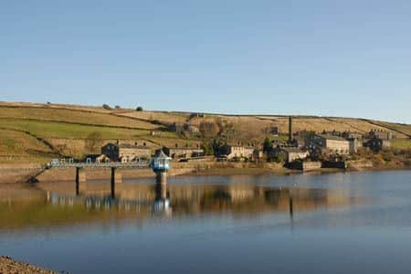
The start is the pleasant workmanlike environment of Oxenhope near the head of the Worth Valley.
Parking is available on the street near the Post office at the junction of Lower Town and the B6141 Denholme Road (Grid ref. SE034348).
Advertisement
Hide AdAdvertisement
Hide AdAfter parking, walk south (uphill) towards Denholme. Bear left along Jew Lane Stay on this lane, which is flanked by cottages, keeping straight ahead on the lower lane at the junction where Back Leeming forks left.
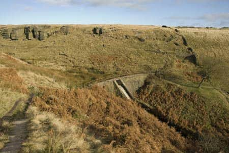
Continuing along the valley the lane crosses the river. Just after the next cottage on the left take the signed footpath leading up to the dam wall of Leeming Reservoir and tarmac track.
Go right along the track, bear left at the fork and after a short way go left onto a signed footpath.
This grassy path (the Brontë Way) contours above the reservoir before descending to cross a footbridge over a stream.
Advertisement
Hide AdAdvertisement
Hide AdContinue half left across the next field, cross another bridge and once on the other side bear right to follow a wire fence up hill.
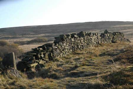
This path leads onto open moors initially with a stone wall on your left. Where the wall ends keep straight ahead and continue uphill to a ladder stile next to a water leat.
Cross this stile and continue aiming for a footpath sign visible on the skyline ahead. Before reaching the sign you join a rough track.
At the sign (grid ref. SE046333) turn right onto Hambleton Lane.
Advertisement
Hide AdAdvertisement
Hide AdStay on this track as it rises gently with expansive views on your left across Thornton Moor Reservoir to Halifax and Bradford beyond.
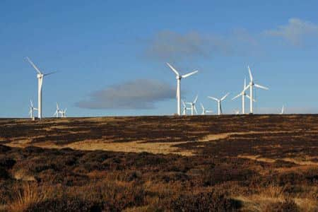
On your right you will see the windmills of Ovenden Moor Wind Farm. As the track starts to descend, look out for a path junction (Grid ref. SE049323).
Bear right and follow the path to eventually reach the deep clough containing Ogden Water on your right.
Continue for a short way and then descend steps on your right to reach the dam across the stream (Grid ref. SE053317). Cross this dam and climb out of the clough onto the moor.
Advertisement
Hide AdAdvertisement
Hide AdThe next section can be a little soft underfoot especially after rain. The way ahead is generally clear as the path roughly heads south west.
Cross the footbridge over the stream in Skirden Clough and continue ahead to reach a track. Turn right to reach the former Withens Hotel (now a private residence) and a road (Grid ref. SE045306).
Turn right along the lane passing the information board that gives a detailed overview of the wind farm. The road deteriorates into a rough wide track.
Pass Warley Moor Reservoir on your left and as the track starts to descend, look out for a footpath sign on your right (Grid ref. SE032324).
Advertisement
Hide AdAdvertisement
Hide AdLeave the road and follow the path along the edge of the escarpment.
You soon encounter some large cairns and other man-made structures, which seem to be built from stone from the adjacent quarries. These add interest to the walk, which now provides a grandstand view north over Oxenhope and beyond. Stay on the edge path to reach Hambleton lane (Grid ref. SE047331). Turn left onto the lane and retrace your steps back to the start.
If you have a favourite walk you’d like to share with us, whether it’s a hidden gem or a popular route, send your walk description and pictures to [email protected].