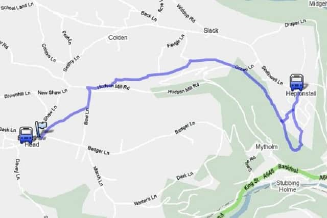
Best Foot Forward: Blackshaw Head to Heptonstall


Map Co-ordinates SD 960276
Look for a stile in the corner of the field, where the path bears half-right along an overgrown path to the next stile, and then head right to a gate in the side of the wall, which turns left down the access road to the building below.
Bear left and then immediately right to take you on to a path behind Shaw Bottom. This surfaced track then becomes a rough lane as you head in the direction of Hebden Bridge.
Advertisement
Hide AdAdvertisement
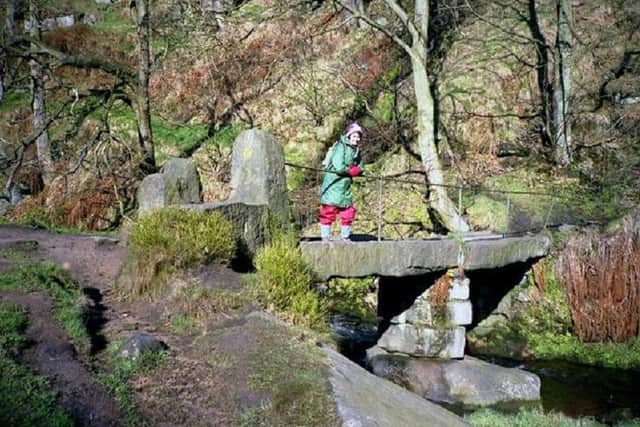
Hide AdA little further on, a sign post on the left hand side of the track points towards the river Colden, where Hebble Hole takes you across to the other side.
At the bottom of these steps, the picnic area here is ideally situated. When you cross the bridge, bear right as it bears uphill and along an ancient paved track. Ignore the first path to your left but carry on to a stile at the top corner of Foster Wood.
This substantial path was once the access road to Slater Ing Mill, a water powered cotton mill in the valley below.
Go through the stile, bearing right to follow the path through fields and stiles, to reach a wider track. Turn left uphill to the junction and then bear right to take you behind some cottages, through more stiles and along a paved way.
Advertisement
Hide AdAdvertisement
Hide AdWhen you reach the final stile a bench is waiting for you to sit and admire the wonderful scenery below.
Continue to follow the track downhill, keeping the wall on your left to emerge onto the road.
Follow this uphill for a short distance to a gap in the wall on your right just past an electricity pole.
Follow this as you clamber over rocks until you emerge at the top of the trees giving you a better view of Stoodley Pike and the surrounding hillside.
Advertisement
Hide AdAdvertisement
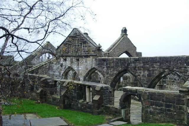
Hide AdHere a path takes you away to the left to Heptonstall where the route finishes.
Thanks to the following who published the walks in this area:
The Calderdale Way website (no longer working)
The Brighouse Boundary Way website (no longer working)
The AA website
‘The Cricketing Heritage of Calderdale & Kirklees’ website.
The Northern Beer Blog - seanliquorish.co.uk
Halifax and Calderdale CAMRA
Walk4Life
Calderdale Council
Mytholmroyd Walkers Welcome
Yorkshire Water
Milestone Society
Hebden Bridge Walkers Action