Best Foot Forward: Chelburn Moor Circular


There is a car park, [Grid Ref SD 967 178], beneath the White House Pub on the A58 between Ripponden and Littleborough which is a convenient place to begin a multitude of walks. The postcode for the pub is OL15 0LG and if you can find the pub, you won’t fail to see the car park. I have not visited the pub, but others on my rambler group walks have, therefore the landlords must not be averse to muddy boots entering to have some well-deserved refreshment after a stroll. One hopes [and assumes] that politics is firmly left at the door and one is not subject to security checks on entering! Unless, of course, Trump has other ideas!
The car park also sits near to the top of the B6138, the longest continuous gradient road in England, a favourite for the more hardy of cyclists, but for others less inclined to this type of transport, it is also a fantastic route for motorbikes, and even in the car it offers beautiful vistas, with the moors of Yorkshire stretching as far as the eye can see. It descends into Mytholmroyd through Cragg Vale, another exceptional area to explore on foot.
Advertisement
Hide AdAdvertisement
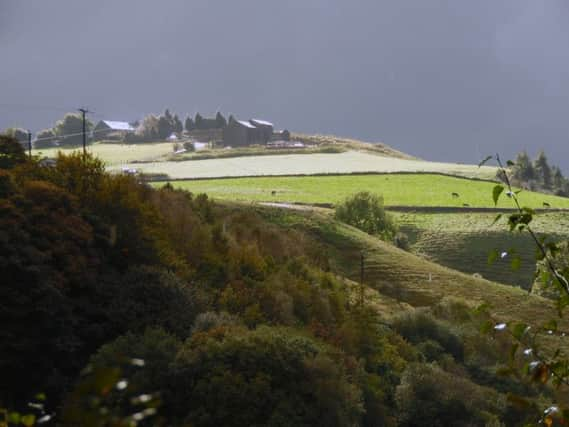
Hide AdThere are, as said, a number of routes to follow from the car park; there is an 8 mile [approx.] flat circular walk around the “Roof of Yorkshire” but this walk will descend into the valley that lies to the west. It is approx. 5.5 miles; it isn’t particularly challenging, one just needs to choose a day on which the weather is more clement, as it is somewhat exposed on the tops. Once on doing this walk my climb out of the valley was spurred on by the fact there was a rather ominous cloud approaching from Manchester, and having reached the car with seconds to spare, we were deluged with lashings of rain which can only be described as biblical!


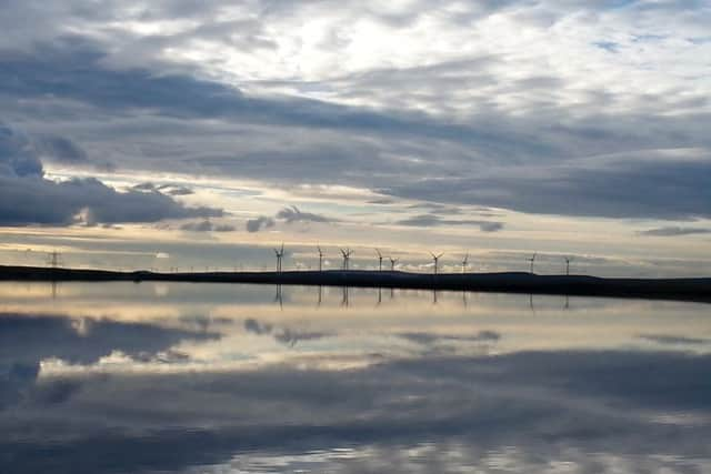
Next to Blackstone Edge reservoir you begin the walk by following the Pennine Way northwards. This path is very well trodden, gravelled in part, flat and clearly waymarked. The land descends to your left into Rochdale and to the right is the rugged moorland so quintessentially “Yorkshire”. On returning to Yorkshire via the M62 from Manchester, I always feel I am home when I see this landscape surrounding me.
After about a mile, you will approach one of the Stanza Stones; one of seven found between Marsden and Ilkley on which are inscribed poems by Simon Armitage; this rock shows his poem “Rain”. Here you can pause to appreciate the poetry, but also to take in the view. If you walk on a clear day, it is even possible to see the Long Mynd in Shropshire; some 80 miles away as the crow flies.
Continue to follow the Pennine Way as it follows the curve of Light Hazzles Reservoir to your right. As one reservoirs ends and the next begins [Warland Reservoir] the path splits. Take the lower of the two, descending slightly to your left, following the Rochdale Way. The path takes a distinct turn to the left. Again, it is waymarked and quite well-trodden. As you descend, you will follow the path around the edge of private land, but you cannot get lost. The path will turn into a track and you will pass through a gate; continue to follow the track into Warland and at the bottom the track turns into a road and weaves past houses until at the very bottom you will meet the Rochdale canal at Lock 35. This canal runs through the Calder Valley and is a good cycling route; taking you through Todmorden, Hebden Bridge and onto Sowerby Bridge; it is also a pleasant, flat route for a Sunday afternoon stroll.
Advertisement
Hide AdAdvertisement
Hide AdThe construction of the canal was completed in 1804 and as it was wider than the Huddersfield Narrow Canal it became the main transport route for cotton, coal and limestone between Yorkshire and Lancashire. After the opening of the Manchester and Leeds railway in 1841 the volume of goods transported decreased significantly,


However through a programme of reducing the canal tolls volumes did increase once more. Eight reservoirs were built to supply the canal, including Hollingworth Lake, which became a pleasure resort and was subject to allegations of “immoralities” occurring as a result of the dancing stages there. The canal declined in the 1950s, with a large section of the route closed in 1952; the construction of the M62 in the 1960s cut the canal in two but there was talk of restoration as early as the 1970s, and in 2002 the full length of the canal was once again navigable.
Cross the canal at Lock 35, turn left and follow the towpath for 1.5km until you reach another lock and the Lock Keepers’ Cottage and can re-cross the canal. Here you will join the Pennine Bridleway and climb back up past a disused quarry, approaching Lower Chelburn Reservoir. Across the reservoir you will be looking at the curiously-named Snoddle Hill. The Pennine Bridleway meanders uphill and you will rise above the reservoirs. You will pass through an animal sanctuary, Leach Farm, and continue to wind gently downhill. Cross the bottom of Castle Drain and shortly afterwards there is a sharp turn to the left. This is the last part of the walk, and is a quite a steep climb up, but you will join a track towards the top, therefore it is easy underfoot and you’ll see the pub up-ahead, so keep climbing and beware of weather sneaking up on you from behind!