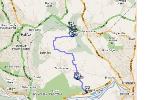
Best Foot Forward: Hipperholme to Cromwell Bottom


Walkers are warned to exercise extreme care at beginning of this section.
Cross the very busy A58 Halifax to Leeds road with care to the gate on the opposite side of the road, and if safe to do so cross the railway line on the wooden boards, passing immediately through the gate.
Advertisement
Hide AdAdvertisement
Hide AdDescend the path to the road below - Shibden Hall Road - where on the opposite side of the road is a gap in the wall to the right of a telegraph pole.
Go through the gap in the wall and descend the steps to a footpath below.
Turn right then sharp left along a footpath through the trees to a stile leading to another field.
Follow this footbridge downhill towards the stream below. (Note. This path can be slippy and muddy when wet).
At the bottom cross over the stile onto Norcliffe Lane.
Advertisement
Hide AdAdvertisement
Hide AdTurn right and head uphill passing a row of houses on your left.
At the top bear right to a gate leading to Lower Place Farm.
On your right is a small stone monument called the Magna Via.
Take time to read this as is next stretch of track provides very interesting information.
Advertisement
Hide AdAdvertisement
Hide AdThis next bit is a bit of a climb, so take care here as you ascend to the top.
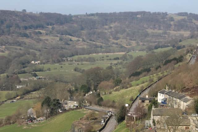
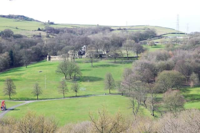
When you emerge with a farm on your left, look over to your right to at the wonderful Shibden Valley below.
Continue forward until you see a road on your left - Marsh Delves Lane - following the road as it winds its way round the farms to the road ahead.
Turn left then take the second lane on your right, ignoring the grassy lane which turns right uphill.
Continue on this track until you reach Marsh Field House.
Advertisement
Hide AdAdvertisement
Hide AdTurn right, alongside a wall on your left to reach a gate behind the garage.
Go through this gate and into a field. Continue along the paved path to the next stile, at the other side of the field.
Go through the stile into the next field and continue forwards until you spot a stile in the wall on your right.
Follow this path as it winds its way downhill towards a farm below. Go through this small stile descend a couple of steps to the road below.
Turn left here then sharp right following a track uphill.
Advertisement
Hide AdAdvertisement
Hide AdOn your right look for a stile in the corner, just before the bend in the road.
Go through the stile and turn right following the wall on your right uphill to another stile to reach the wood.
Turn left uphill to another stile, crossing the field towards the quarry ahead.
When you reach the quarry, turn right and follow the diversion as it follows the edge of the quarry and the front of the farm.
Advertisement
Hide AdAdvertisement
Hide AdAs you emerge at the front of the farm, head towards the church on your left.
Continue along the track until you reach the main road - Church Lane, Southowram.
Turn left and follow the road for a short distance until you reach the entrance to a house called Stonecroft.
Cross the road and follow a path alongside the church car park on your left to emerge at a stile.
Advertisement
Hide AdAdvertisement
Hide AdCross the stile and follow the path as it bears right to join the Calderdale Way.
Follow the path as it descends on a steep and slippy stone track over a stream, passing through a small gap in the wall to emerge on a farm lane at the top.
Turn left and follow the lane past Cote Hill Farm, crossing a stile at the left of a fence and continue to the next gate passing through another stile ahead. Follow the wide track as it bends round to the left, becoming Ashday Lane.
Turn left down Ashday Lane, passing Ashday Hall and later Boggart House on the right.
Beyond Boggart House is a stile leading to Far Binns.
Advertisement
Hide AdAdvertisement
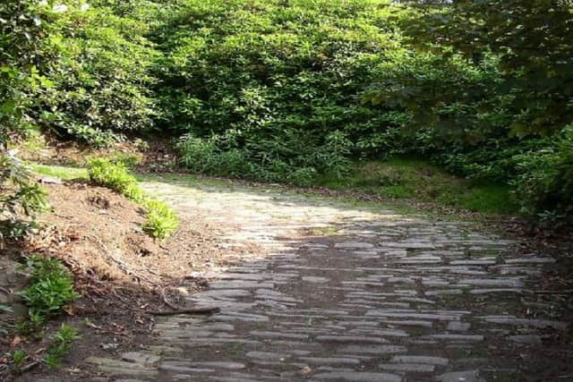
Hide AdThis footpath was an old wagon way which was used to bring quarried stone down to Tag Lock on the Calder and Hebble Navigation Canal.
If you look carefully, you will see the rutted evidence of wheels on the flagstones which are part of the surface of the footpath on which you are walking. The path continues downhill to a junction of paths.
Turn left over the stile on your left, descending downhill towards the stream on your right to emerge onto a wider track at the bottom.
Turn right and follow the track to the main road to Cromwell House on the A6025 Brighouse to Elland Road.
The next part of the road continues across the road towards the canal and railway line.