Best Foot Forward: Pecket Well to Luddenden Dean


Map Co-Ordinates : SD 996292
This is a high level route round the moor edge requiring care in misty weather, but when it’s clear, unfolding views of Stoodley Pike, Heptonstall, Scout Rock, Crow Hill and Emley Moor mast, before dropping down to Jerusalem Farm.
From the bus shelter on Hebden Bridge to Keighley Road (A6033) near Pecket Well, cross this road then climb to a seat and stile on to the road above. Turn right along this road towards a bus shelter on your right, just before you get there, turn left to a small group of buildings. Shaw Croft Hill.
Advertisement
Hide AdAdvertisement
Hide Ad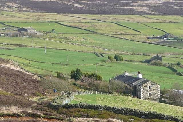
Turn left on reaching the houses, following a grassy track. Ignoring the path from the left.
After passing beneath electricity cables turn up a walled track to Slack Farm. Continue up this track over a wooden stile, then turn right at the top, following the wall to another stile pointing the way through an equestrian centre.
At the end of this track, turn left just past the reservoir which is on your right.
The path will take you to another stile, where you need to turn right towards the next farm.
Advertisement
Hide AdAdvertisement
Hide Ad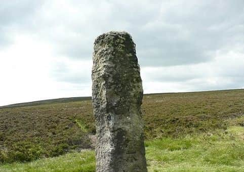
Bear left away from the farm to the entrance of the moor. Enter through the stile to follow this all the way round. This is Norland Moor.
To your right of the moor sits the Golf course, on the other side of the fence. Keep following this path as it bears left to take you further onto the Moor itself.
Go over this stile to follow a more defined track. In the distance two lonely trees stand beside a wall.
To the left stands Churning Milk Joan, a guide post to help you navigate towards Luddenden Dean. As you get closer, the wall comes in to view. Follow this wall to the end to where a short path takes you uphill to the left to reach Churning Milk Joan.
Advertisement
Hide AdAdvertisement
Hide Ad
Also known as Churn Milk Peg and Nelmires Stoop. The 1854 six-inch map gives an alternative name ‘Savile’s Lowe’ but this seems more likely to have been one of the mounds that sometimes mark the old township boundaries (here between Wadsworth and Midgley).
Savile would be Lord Savile, who owned several manors in Yorkshire. It is a 2m high stone pillar, carved only with a bench mark (a strange place for one!).
From here, follow the path back downhill, bearing diagonally left, aiming for each of the small yellow sticks in the ground. At the bottom of the hill, bear left to follow this route, keeping the bottom of the moor on your left and the top of the fence on your right.
You will come across a Calderdale Way sign a little further on your left, and then very soon after that, a stile on your right finally brings you off the moor.
Advertisement
Hide AdAdvertisement
Hide AdOn the opposite side of the stile, a tarmacked road appears from a building on your right to take you downhill. The route now bears left downhill and then right and then left. When you reach the third farm. Dry Carr.
Turn right down a track and then left beyond the farm buildings onto a field path, which comes out on to Jerusalem Lane. Follow this downhill to reach Jerusalem Farm.
This is no direct bus service here, but the nearest is only another 15 minutes or so away. To reach the stop, keep following Jerusalem Lane all the way to the bottom and then turn right in to the village. Follow this to where the bus turning circle is on your right.