Best Foot Forward: Ripponden Milestones


Our journey starts outside the Old Bridge Inn, probably the oldest inn in Yorkshire first recorded in 1307 as the home of a yeoman clothier.
We can see the old bridge on the right, beneath the current one over the river Ryburn, with the watermill race.
Advertisement
Hide AdAdvertisement
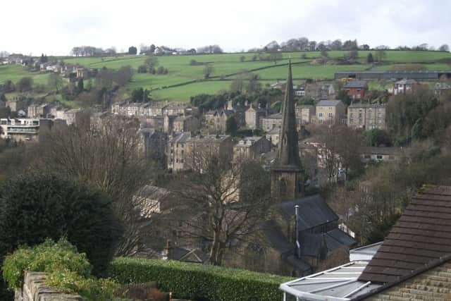
Hide AdThe splendid St Bartholomew’s Church overlooks the river Ryburn and a stream called Cob Clough runs under the grave yard in front of the church.
This is the fourth church to stand on this site; the second church and a considerable proportion of the graveyard were washed away in May 1722 when the stream flooded.
Turn up the cobbled Priest Lane, where the vicarage of St Bartholomew’s is situated. Note the bollards at intervals in the base of the wall on the left-hand side; these were used to stop carts running away down the slope or from hitting the wall.
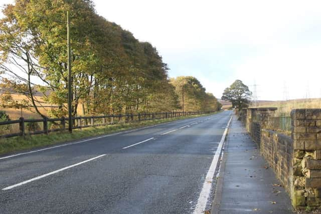
Turn left when you reach the A58 Halifax Road. The Halifax-Rochdale Road with its branch to Elland was the first route to cross the Pennines, turnpiked in 1735.
Advertisement
Hide AdAdvertisement
Hide AdBecause road travel was slow and difficult and better trade routes were needed, Turnpike Trusts (groups of local worthies) were set up by Acts of Parliament from 1706 to 1840s, to repair and later to extend the highway network.
Users were charged tolls to pay for this work. The name ‘turnpike’ comes from the spiked barrier at the Toll Bar.
From 1767, mileposts were compulsory on all turnpikes, not only to inform travellers of direction and distances, but to help coaches keep to schedule and for charging for changes of horses at the coaching inns.
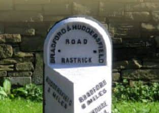
Walk to the corner to find a milestone, patiently awaiting restoration after being defaced in WWll to baffle any German invaders.
Advertisement
Hide AdAdvertisement
Hide AdOn the right hand corner is the Tollhouse jewellery shop, probably the scene of many arguments about the tolls charged, which were resented by travellers.
Retrace your steps and continue along the Halifax Road to cross at the pedestrian lights. Turn right to continue along the Halifax Road, taking the footway beside the pillar box. Follow this pavement as it bears left at the end of the houses and walk up past the beech hedge, cross diagonally to your right, to a green wrought-iron gate. The right-hand gatepost conceals a milestone section inscribed ‘Elland 4 ¾ miles’.
Turn back down-hill, following the wall. As you turn the corner leftwards, opposite 188 there is another part-milestone lying face down on top of the wall.
Crawshaws the local builders and quarryowners owned these cottages; they retained pieces from buildings they demolished and these milestones may be part of their collection.
Advertisement
Hide AdAdvertisement
Hide AdContinue along the back way and turn right at the end, down a setted lane to the Halifax Road and turn left. Cross the road with care at the ’40 mph’ sign.
Continue along the pavement. At the playing field, enter and walk down to the permissive path that runs alongside the wall, to the riverside. There is a stile by the riverbank; notice the winding gear for the sluices to your right.
Turn left along the river bank, noting the cascading torrent of the weir and the high wall supporting the railway embankment on the far side.
Our first wayside water-feature is a stone drinking trough, fed by a raised channel.
Advertisement
Hide AdAdvertisement
Hide AdAs the bridge comes into view, note a marker stone on the bank on your right and then an irrigation ditch on your left, with large stone chambers.
Join the old packhorse track as it drops down from your left from Kebroyd and cross the bridge. Bear right up the path, noting the substantial stones and setts that still pave it.
After the Romans left, there was no systematic road construction until the turnpikes. Goods were carried by packhorses through the Middle Ages and later, because the highways were not suitable for wheeled vehicles; usually a flagged stone causeway was the best surface, often with a sunken lane or holloway alongside, to permit passing. From 1555, the parishes and townships were made responsible for the maintenance of their roads. Individuals had to
provide compulsory labour or a payment in lieu, the earliest form of ‘rates’ or council tax called the Composition – which was most unpopular.
Advertisement
Hide AdAdvertisement
Hide AdFrom 1697, the Justices were required to erect waymarkers (‘stoops’) on the moors and where tracks crossed, to guide travellers.
Continue up the path and cross left over the bridge of the old Lancashire and Yorkshire railway (1878).
Turn left and climb the rough track through ancient woodland to a house. Keep to the path as it passes to the right of the house, then it doubles back to the right in a U-bend.
Follow the path uphill, noting a guidepost or stoop in the wall on the left as you climb. Follow the wall to the left as it bends, past a sunny grassy bank, good for a refreshment stop at the half-way point of the walk.
Advertisement
Hide AdAdvertisement
Hide AdContinue up the track. Just before a large stone gatepost, there’s a footpath marked ‘beware of the bull’ through a squeeze stile on the right,
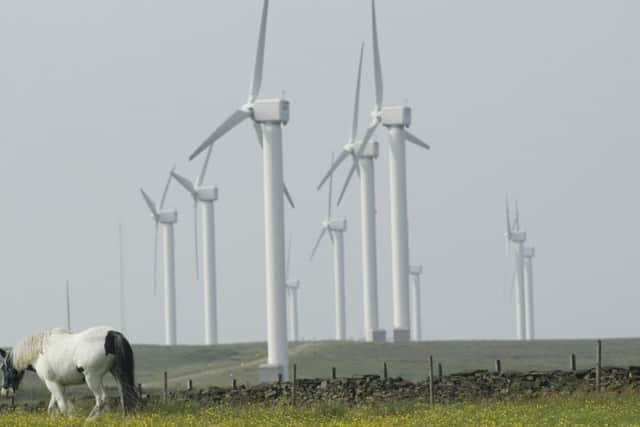
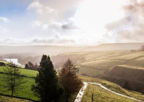
This is a shorter way back to the starting point but can be very boggy so we proceed uphill as the woodland opens into fields. Take the Calderdale Way signposted to your right, through a squeeze stile, noting a stonewalled corral further up the path. Enjoy the extensive views to the windfarm at Ogden Water
and up the Ryburn valley.
Follow the Calderdale Way path along the wall.
The springs can make it boggy; if so, walk higher up the field. Through the stile by a gate, there is a thoughtfully-placed seat as underfoot becomes a grassy track. Admire the switchback dry-stone walls traversing the hilly landscape and the example of a crenellated top on the substantial wall of the track.
Go through the gap stile, past a Yorkshire longhouse, being extended. The track is hardsurfaced now. Pass Moorbottom House, noticing another walled track that once accessed the hilltop. At the end of the track is the Ripponden to Elland branch of the turnpike, forking to Greetland.
Advertisement
Hide AdAdvertisement
Hide AdTurn left to find ‘The Cross’, with a triangular stone against a drystone wall between the forked roads. This is reputed to be the base of a cross, although the cross appears to have been situated at the next junction towards Barkisland, so the stone may be a boundary marker.
The hardy may wish to extend their wander to Barkisland to see a cast-iron milestone on Saddleworth Road and a defaced milestone on Greetland Road, but our walk turns back to Ripponden. Walk down the pavement on the left-hand side. Shortly you will see The Fleece.
Passing Bank View House, cross the road. You can bear right down Old Bank following the Calderdale Way back to the start point, but we continue down the pavement of New Bank, watching the old track descending below and noting the narrow walled path down to the church from opposite Mount Pleasant.
Two more ‘water features’ may be seen on the left. As the road begins to bend sharply to the right, look across to an original 18th century turnpike milestone, one of the oldest milestones you are likely to see.
Advertisement
Hide AdAdvertisement
Hide AdContinue down the righthand pavement; our last water feature is a stream running far below, under a high wall; a bollard now almost obliterated by the tarmac once protected the bridge wall.
As you pass the old School House, turn right down a short flight of steps by some black iron railings, to join the road from the Old Bank.
Admire the interesting historic buildings, turning left past the Field of Hope and looking back at the picturesque archway of no’s 8 & 9 Old Bank.