Best Foot Forward: Rochdale Canal and Warland Reservoir


Reaching Warland Reservoir a section of the Pennine Way is joined before dropping down into Calderdale to rejoin the canal.
Length
6.5 miles / 10.6 km
Ascent
1000 feet / 303 metres
Grade
Easy/mod
Start - OS grid reference SD934221. Lat 53.695299 // Long -2.101433
Postcode
OL14 6PZ (approx. location only)
Advertisement
Hide AdAdvertisement
Hide AdThis walk explores some of the high ground above Calderdale.
The route includes some steady climbing for about a mile from the canal to Warland reservoir.
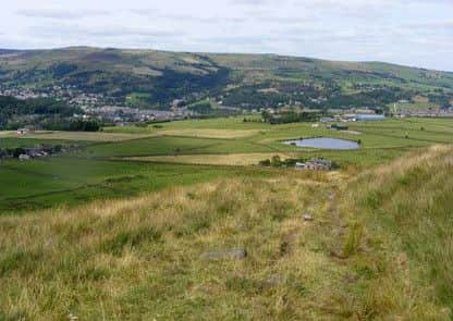
Once the high ground has been gained you can relax and enjoy the views.
The start is Hollins Road. Walsden (Grid ref. SD934221).
If coming from Todmorden on the A6033 Todmorden to Rochdale road, Hollins Road is after the A681 Bacup road forks off to the right.
Advertisement
Hide AdAdvertisement
Hide AdOpposite the prefabricated Walsden Library on the right is a road signposted Lumbutts and Mankinholes.
This is Hollins Road.
Please park with consideration for local residents.
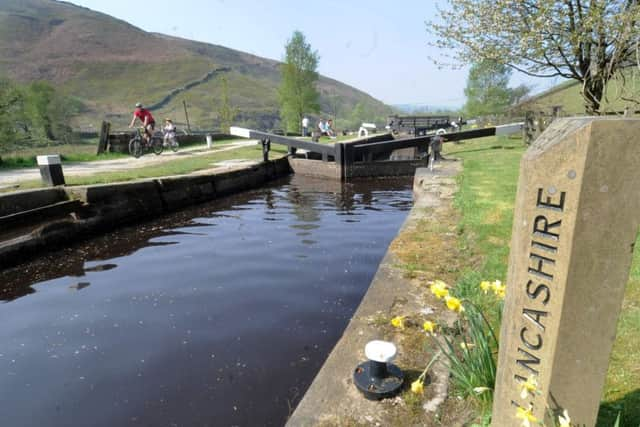
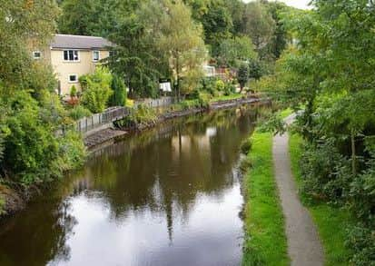
After parking walk up Hollins Road to the canal bridge. Drop down the ginnel to the towpath, turn right, under the bridge and proceed ahead toward Winterbutlee lock.
Accompany the beautiful and isolated rural towpath for about a mile and a quarter until you come to a little stone bridge in open country with the walls of Warland high up on the left on the other side of the canal.
Cross the bridge and take the path through the well disguised gate climbing to the right on the left of a wall.
Advertisement
Hide AdAdvertisement
Hide AdThis bears left to a gate at the top corner of the field, with the walls of Warland looming over you.
Cross the gate and accompany the wall along into a short ginnel leading to a road.
Cross over and continue on the road leading uphill. You come to a fork - keep ahead through the side gate and proceed up the tarmacked drive, passing a house, some noisy dogs and an extraordinary number of parked cars on the way up.
Keep on the track that bears right behind the isolated farm, through a gate and on left up the hill.
Advertisement
Hide AdAdvertisement
Hide AdWhen you arrive at the foot of the reservoir embankment, leave the track and climb the embankment by a narrow path slanting to the left.
At the top turn left along the track beside Warland Reservoir.
You are now on the Pennine Way.
Continue on this track past the end of the reservoir and on the left of a culvert, ignoring a tempting path with beguiling yellow markers.
Soon after, where the track bends right, (grid ref. SD955217) leave the Pennine Way, and proceed left on a clear slabbed path along the left bank of a large ditch.
Advertisement
Hide AdAdvertisement
Hide AdIn due time this path bears left and then right to take you along the embankment of Gaddings Reservoir.
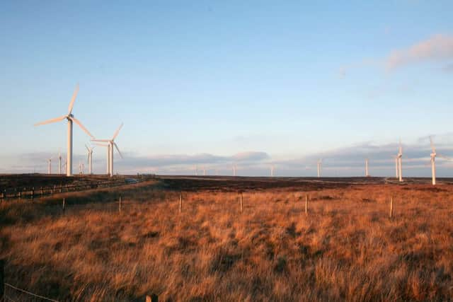
Look out for the proud outline of Stoodley Pike to your right, and the wind farm of Ovenden Moor (Yorkshire’s biggest) ahead in the distance.
At the far corner of the embankment take the obvious path dropping half-left. Follow it down.
You pass the Basin Stone on your way at grid ref. SD944223.
The Basin Stone is a natural weathered outcrop of millstone grit on Walsden Moor, part of Langfield Common, not far from Gaddings Dam. Ideally shaped for pulpit use, The stone was the location of radical meetings of the Chartists, Hudsonites and later Socialist groups.
Advertisement
Hide AdAdvertisement
Hide AdOn August 18th 1842, following the Plug Riots in Halifax Ben Rushton addressed a large Chartist meeting at Basin Stone.
A painting of this scene by AW Bayes hangs in Todmorden Town Hall. Presently, after crossing a causeyed path (The Mary Townley Loop / Pennine Bridleway) the path develops into a broad track and curves right down to a wall.
At this point a suspension of disbelief comes in handy. Turn back left keeping the wall on your right.
Follow the wall for about 200 yards.
This is tricky. The path is generally unwalked, there are boggy areas, but it is the right path!
Advertisement
Hide AdAdvertisement
Hide AdGo over the stile at grid ref. SD935227 initially alongside, then within a walled green lane leading to a large farm. Go through its gate and pass to the right of the building. Where the path diverges, head left, and follow this as it zigzags downhill.
This brings you out at Chapel Top at grid ref. SD931228. Turn left and walk to the T junction, then ahead and drop down right to the main road.
Turn left over the canal bridge, gain the towpath via the ginnel, and follow it bridge 34, where you climb to the road and turn right in Hollins Lane once more to regain your car.