Best Foot Forward: The Wilds of the West Yorkshire Moors


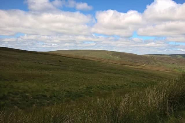
On a bright and blustery Sunday morning I wanted that ‘escape’ and so headed up to the moors above Todmorden, where at points you have a 360-degree perspective and see nothing of civilisation save for an isolated farmhouse. Stansfield Moor, the edge of which begins this 8-mile route, is a geological anticline – essentially a curved fold of rock, which dips steeply on the Lancashire side, but flatter to the East. Much of this walk occurs on the moorland plateau, where high levels of rainfall and low levels of evaporation onto impermeable rock explains why the high ground remains so wet throughout the year.
Close to the extra-terrestrial looking VOR beacon [a short-range radio navigation system for aircraft] perched on the edge of Pole Hill and above Bride Stones Moor, there is a building that was probably once a pub, with a large place to park. This is on Kebs Road, GR SD 927 272 accessible via country roads from Blackshaw Head and Todmorden. Kebs Road leads onto The Long Causeway, an ancient track running high above the valleys beneath, close to which Bronze Age settlements have been found.
Advertisement
Hide AdAdvertisement
Hide AdThere is a way-marker pointing over a stile towards the moorland with a well-trodden path that will curve around to the right and pass along a short ridge. Ahead there is a small field of trees and the beacon will come into view.
Passing between the trees and the beacon you’ll arrive at a distinct track – Dukes Cut. Turn left and follow the track for about 1km until a junction, Four Gates End, with a farm track descending to your left. There is a way marker [left] just outside the farmland perimeter; follow the fence through the field, as there is no clear path. You’ll have to wade through soggy ground and a lot of bracken, but keep following the fence until meeting the stream, Noah Dale, passing over a very pretty stone bridge. Rise slightly between two stone walls, turning left towards a charming deserted house that inspires thoughts of Wuthering Heights-esque stories of remote moorland living. Moving beyond the house, the path is clearer and when reaching a way marker [GR SD 928 292]; turn right to climb gently onto Hoar Side Moor. Luckily by spotting the way markers you can follow the designated path; but for about 1.5km you will orientate yourself in the same direction. The way-markers disappear around Clegg Clough, but the path is visible. On the opposite bank you’ll see what I assume to be grouse butts, and the path slowly curves around to the right with a derelict barn will coming into view, marked Raistrick Greave on the map. You eventually meet a way-marker, turning left towards the building. Passing between the building and the boundary walls of the fields to its front, you will start to descend until you are walking right alongside another stream, Clegg Foot. The path here was very boggy and not at all clear; once again a walking pole doubled up as a ground prodder helping to find solid earth!
Ahead you’ll see a new building; presumably another shooting hut. Walking a plank across another stream, climb up to meet the stile ahead. Turning right, this track will continue to Gorple Lower Reservoir, picking up the Pennine Bridleway to cross the reservoir dam. Beyond Gorple Cottages, the Pennine Bridleway turns right and you will climb again back onto the moorland. We had the first of two close encounters with cows along the Bridleway, passing resting mother cows with their calves; not desirable as mother cows can be rather cantankerous in defence of perceived threat. Luckily this group paid us little attention and we continued ahead. You will pass a way-marker indicating Blackshaw Head 2.5 miles ahead and shortly afterwards, turn down a track on the right, signposted by way marker. Turning right again, pass behind the buildings and follow the path between a narrow lane until it turns left [GR SD 946 297] and descends through the fields. I must confess I became a bit lost at this point, but we turned left too soon. Cross the stream at the bottom and climb up the other side. Because of our slight diversion, we had round two in the cattle battle; entering a field of very curious calves who bounded towards us, closely followed by their mums. Hastily retreating to climb over a wall and skirting around them; you realise the necessity of not wandering off a public footpath in error!
With relief, we spotted a way-marker and were back on track. Continuing to climb, the bridleway will take you to a metal gate [Three Gates End], which meets Greenland Road. Turning right, you’ll soon be back on Duke’s Cut, where you walk the beginning of this route in reverse back to the start. Not always an easy route underfoot, and a walk that I would advise to people with some experience who can orientate themselves with a map and compass, this was nevertheless a fantastic afternoon’s hike.