
Hebden Bridge floods: How park, roads and parking will be hit while Calderdale town's flood defences are built
More details have been revealed about how Hebden Bridge will be affected if plans for flood defences go ahead.
As reported by the Courier, plans for the £81m scheme have now been submitted to Calderdale Council for consideration.
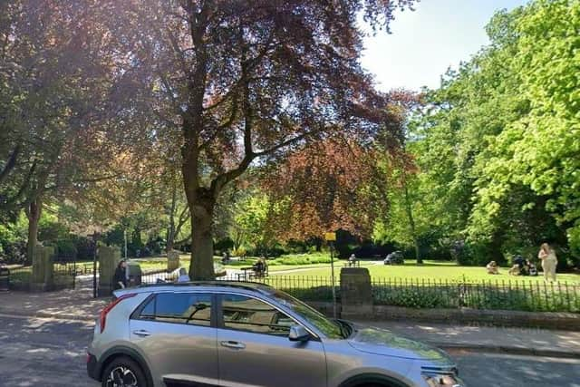
If approved access to Calder Holmes Park will be restricted while it is used as a construction compound.
Some roads will be affected and although some proposed impacts will be temporary, there will also be some permanent changes, according to the Environment Agency (EA).

In the EA’s planning, design and access statement, submitted with the application, it says the main aim is to restore access to an equivalent standard to what was available prior to construction and to prioritise the safety of vulnerable road users throughout the design and construction process.
Disabled parking spaces and pedestrian accesses will be maintained wherever possible during construction, says the EA, who add they have consulted with businesses and other stakeholders about the issue of access, including Hebden Bridge Disability Access Forum.
“The scheme will adopt best practice approaches to managing and mitigating disruption to access for all users.
“Duration/order of some works will inevitably adjust before and during construction.

“Stakeholder consultation will continue throughout the scheme to ensure impacts are minimised,” say engineering consultants Mott MacDonald in their statement.
A series of permanent and temporary alterations to access are proposed.
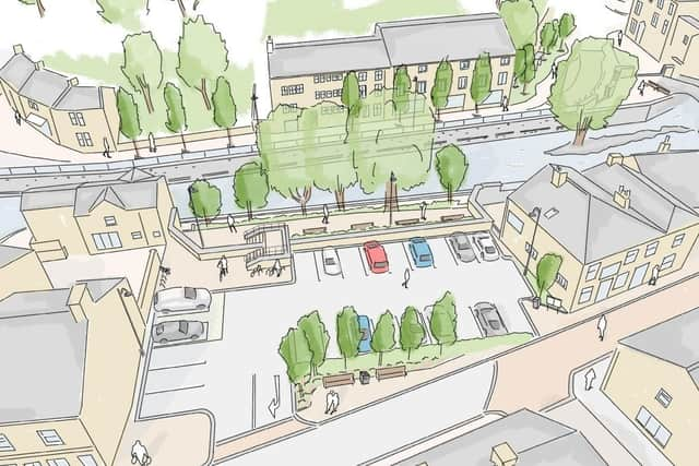
According to the document, permanent alterations will result at St Pol car park, which will be reinstated but layout reconfigured to make best use of the remaining space while meeting modern highway design standards.
There will be a combined entry and exit point and standard parking spaces reduced from 28 to 21. The two existing blue badge spaces will be retained but repositioned.
Old Gate will become a “no stopping” road, losing around 21 pavement-side parking spaces, with a “drop off” point being created.
Other changes will be temporary, including installation of an overbridge on Princess Bridge – over the Rochdale Canal – on Station Road, for construction vehicles which will be stored at Calder Holmes Park.
Access to Calder Holmes Park from Station Road will temporarily be widened to create two working lanes of traffic into the park compound.
This will involve demolishing a section of the boundary wall, the removal and storage of the heritage wall plaque, and removal of four trees.
This is needed to achieve the necessary width to allow safe access for vehicles using the compound and to minimise the risk of bottlenecks forming at the junction onto Station Road, and then at the junction on to the main A646 Burnley Road, says the document.
When the compound is no longer used, these will be restored.
“Some temporary traffic management may be required to manage traffic flow at these two junctions and those plans will be refined in conjunction with Calderdale Council, as part of the construction transport management plan to be produced prior to using the compound,” says the statement.
Although public access will be restricted to the park, the existing footpath south of the park will still provide a direct pedestrian route to the railway station.
The existing footpath to the north will remain open but with a restriction or curtailment where it reaches the access road to the construction compound.
Access to the Rochdale Canal towpath will remain, and the café and skatepark will remain accessible, say Mott MacDonald.
As well as Calder Holmes Park, the compound which was used for the completed Mytholmroyd scheme will also be used.
St George’s Bridge will be inaccessible by vehicles when the bridge structure is being strengthened, resurfaced and the flood panel installed and although pedestrian access will be retained where possible, there are expected to be periods of alternating full and partial closures for up to ten months.
Vehicles will be diverted via the A6033, Foster Lane, Windsor Road, Victoria Road and Valley Road.
Central Street Footbridge will be inaccessible by pedestrians while the bridge structure itself will be demolished and replaced.
At Old Gate, pedestrian access to homes and businesses will be maintained and works sequenced to avoid any closures being at the same time as access restrictions on St George’s Bridge or New Road (West End) Bridge.
Bridge Gate will be temporarily inaccessible to vehicles from the south directly from the A646 to allow for construction works in this area – approximately 15 months with diversions in place – and vehicular access to businesses on Bridge Gate will need to be from the north via the A6033.
St Pol Square car park will be closed for vehicles and pedestrians for the full time that works are being staged from this area – approximately three years – until the new car park is reinstated.
Riverside Walk will be closed to pedestrians for around 18 months due to works on the river walls here and in the surrounding area.
The car park and rear seating area serving the White Lion Hotel will be used to construct the new flood wall behind the hotel, as well as being a working area for the Innovation Mill weir modifications, and other local interventions – the area will be temporarily unavailable for around 12 months.
Diversions will be in place when access to any of these places is restricted.
There will be other temporary changes including road and footway closure and diversions, and restricted access to specific private properties in the town, but these routes will be reinstated once the development has been completed, according to the statement.
Temporary access will also be needed for work to be done on some weirs, including at Lower Mill Weir, Foster Mill Weir and Mayroyd Weir.