Worked stepped up to improve railway track drainage to prevent floods in the Calder Valley
and live on Freeview channel 276
Increasing flood resilience being undertaken by Calderdale Flood Recovery and Resilience Programme Board partners include work across the Yorkshire-Lancashire border by Network Rail.
Flooding impacts railway services in extreme weather events, in the past closing Walsden Station, while floodwater flowing off the tracks has added to flooding emergencies.
Advertisement
Hide AdAdvertisement
Hide AdMuch of the work is in the Calder Valley and includes joint work with the Environment Agency (EA) at Walsden to reduce flooding from Ramsden Clough Reservoir.
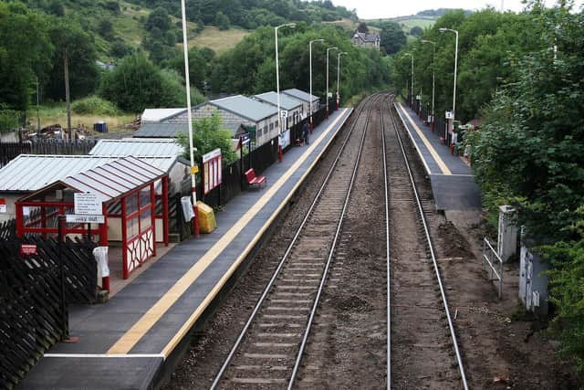


Network Rail are also renewing track through Summit Tunnel to improve resilience and reliability of the track, and are completing a drain clearance through the tunnel.
Completed resilience work undertaken by Network Rail west of Stubbing Brink, Hebden Bridge, clearances under a key bridge, improved culvert work at Dobroyd, Todmorden, and major culverting work at Kitson Wood, Todmorden.
In the future Network Rail aim to increase trackside drainage at Stubbing Brink, repairing trackside drainage at Mytholmroyd, Brearley and Sowerby Bridge and working with the EA on “slow the flow” schemes relating to Ramsden Clough.
Advertisement
Hide AdAdvertisement
Hide AdEast of Stubbing Brink major work to replace a failed culvert at Wood Lane overbridge, at Tenterfields Industrial Estate, Luddenden Foot, minor works on the line at Brearley and Stubbing Brink, work to improve highway drainage beneath a railway bridge at Stainland Road, Elland, and development work to better protect neighbouring houses at Mytholmroyd will also be in progress.
Among other partners, Calderdale Council data collection work on the flood report into the Storm Ciara event in February 2020 is complete and consultants appointed to produce a report, but similar work on a report relating to a flood incident in March 2019 has still be be completed albeit with actions arising from it being taken forward.
Until the end of November 2021 the council was investigating 101 reporting flooding sites of which just three still require a site visit.
Cameras and flow monitoring have been installed at Redwater Clough, Cornholme, Stoney Royd Lane, Todmorden, Nutclough, Hebden Bridge, Copley, Halifax, and Jumps Road, Todmorden.
Advertisement
Hide AdAdvertisement
Hide AdThe EA has £4 million worth of work nearing completion with three of 20 schemes still in progress including retaining wall issues at Streamside, Mytholmroyd, wall works at Callis Bridge, Hebden Bridge, and some repairs at Millwood, Todmorden.
Northern Powergrid is continuing to replace or re-site power sub-stations to make them more resilient to flooding.
Yorkshire Water, the Canal and River Trust and Northern Gas network are also involved in addressing resilience issues, the board heard.
* Support your Halifax Courier by becoming a digital subscriber. You will see 70 per cent fewer ads on stories, meaning faster load times and an overall enhanced user experience. Click here to subscribe
Comment Guidelines
National World encourages reader discussion on our stories. User feedback, insights and back-and-forth exchanges add a rich layer of context to reporting. Please review our Community Guidelines before commenting.