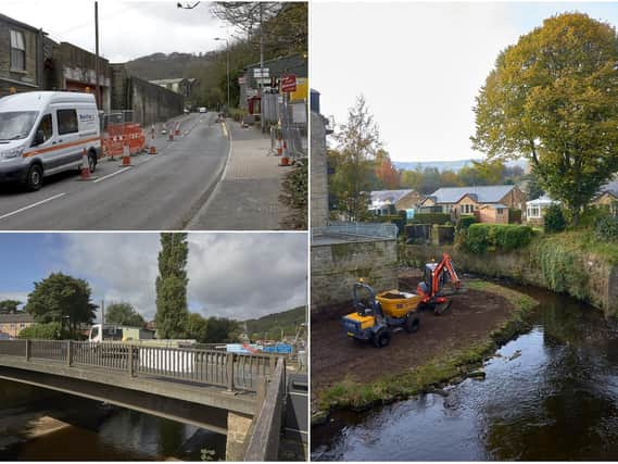
Refusal of plan would cast doubt over £30m flood prevention schemes


Calderdale Council’s Planning Committee saw the proposals under attack from worried residents who fear raising river walls on the south bank of the River Calder at Mytholmroyd will place their downstream homes at Riverside Cottages, Burnley Road, at greater risk of flooding for minimal upstream gain.
But a senior advisor for the Environment Agency, which has made the application, said the EA had “worked tirelessly” to develop a robust hydraulic model on which a base design has been created underpinning the six areas of work in the area which had already been approved.
Advertisement
Hide AdAdvertisement
Hide Ad“Refusal would call into question the validity of the whole scheme and £30 million of funding committed by Calderdale Flood Partnership Board,” he said.
Councillors gave permission for the EA to widen the river channel on the Calder’s south bank next to, and downstream of, St Michael’s Church, “flood proof” properties at 24 to 38a Burnley Road and the Royal Oak apartments, install a rising flood gate on the north bank and pedestrian gates at the County Bridge footbridge, extend minor parapet repairs, raise flood walls to the north and south banks, and create a public open space at the junction of New Road and Burnley Road, all in Mytholmroyd.
Earlier, speaking on behalf of objectors, resident Anthony Milroy took issue with the Environment Agency’s modelling and claimed residents had eye-witness, mobile-phone filmed and broadcast footage as prima facie evidence contradicting it.
“The actual realities of Mytholmroyd’s floods directly contradict the virtual realities of the EA’s digital models,” he said, outlining a description of watercourse breaches and back-ups.
Advertisement
Hide AdAdvertisement
Hide AdThe changes would only provide brief respite at County Bridge while posing a greater danger downstream to residents homes at Riverside Cottages, Burnley Road, he argued.
“Raising channel walls will only delay the back-up overspill above County Bridge by less than two minutes and below County Bridge by ten seconds,” alleged Mr Milroy.
He said residents believed the higher walls would raise peak flood water levels above the self-draining and drying out basements of Riverside Cottages and risk damaging their properties more seriously.
Several residents had complained in writing that raising the wall level on the opposite south bank, where past the church there was a blowing green and tennis courts, would increase the threat to their homes.
Advertisement
Hide AdAdvertisement
Hide AdThey had been assured by the EA and contractors VBA that river walls below County Bridge would not be raised in height but in January this year contradictory proposals had been issued which would do that, said Mr Milroy.
He criticised consultation levels and said: “We have five minutes for these plans to be properly scrutinised and discussed. There have been no other discussions or scrutiny, everyone’s waved these through.”
Upper Valley catchment areas which would prevent rapid peak run-off into riparian channels downstream remained neglected as did silt clearance at critical pinch points, he said.
The EA representative said Mr Milroy’s figures were not correct. The agency used gauged data.
Advertisement
Hide AdAdvertisement
Hide AdCouncillor Stephen Baines (Con, Northowram and Shelf) asked if the EA as confident that other measures being undertaken in upper areas of the catchment would reduce flooding risk and the EA spokesman replied “absolutely”.
Proposals to remove balconeys at the back of Riverside Cottages were dropped by the EA. Residents had said these were not only valued amenities but had offered an escape route from flooding problems on the main Burnley Road in front of their homes.