Storm Eunice Calderdale: Hour by hour weather forecast as yellow warning remains in place for high winds
and live on Freeview channel 276
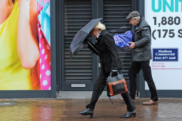
Storm Eunice is the second storm to hit the country in as many days following the disruption caused by Storm Dudley.
Strong winds and continued disruption is expected for much of the UK on Friday with a rare red weather warning in place for parts of Southern England and Wales.
Advertisement
Hide AdAdvertisement
Hide AdThe yellow warning means a small risk to life with travel delays, road and rail closures, power cuts and damage to property all likely.

Here is an hour by hour weather report as Leeds braces itself for possible snow:
Today (Friday, February 18)
9am: Cloudy and sunshine
Chance of rain: 10 per cent
Temperature: 6 °C
10am: Light shower
Chance of rain: 50 per cent
Temperature: 6 °C
11am: Heavy rain
Chance of rain: 90 per cent
Temperature: 6 °C
Midday: Heavy rain
Chance of rain: 95 per cent
Temperature: 5 °C
1pm: Heavy rain
Chance of rain: 95 per cent
Temperature: 3 °C
2pm: Heavy rain
Chance of rain: 90 per cent
Temperature: 3 °C
3pm: Heavy rain
Chance of rain: 90 per cent
Temperature: 3 °C
4pm: Light shower
Chance of rain: 50 per cent
Temperature: 3 °C
5pm: Cloudy
Chance of rain: 20 per cent
Temperature: 3 °C
6pm: Light rain
Chance of rain: 60 per cent
Temperature: 3 °C
7pm: Light rain
Chance of rain: 50 per cent
Temperature: 3 °C
8pm: Light shower and sleet
Chance of rain: 50 per cent
Temperature: 2 °C
9pm: Cloudy
Chance of rain: 20 per cent
Temperature: 2 °C
10pm: Cloudy
Chance of rain: 20 per cent
Temperature: 3 °C
11pm: Light rain and sleet
Chance of rain: 40 per cent
Temperature: 3 °C
Saturday:
A cold and bright start, with some wintry showers, mainly on hills. Meanwhile, an area of rain and hill snow is likely to arrive from the west during the afternoon. Maximum temperature 8 °C.
* Support your Halifax Courier by becoming a digital subscriber. You will see 70 per cent fewer ads on stories, meaning faster load times and an overall enhanced user experience. Click here to subscribe