Best Foot Forward: A moorland escape above Ripponden


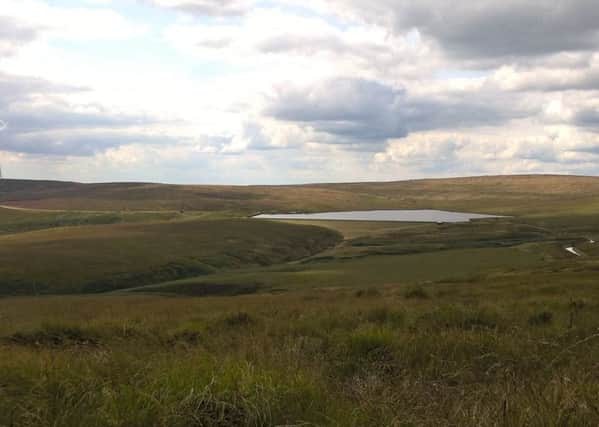
Quickly leaving behind all signs of civilisation, you really get a sense of the expanse of the moorland, which is strangely contrasted by the ribbon of the M62 which flows through the landscape during the second part of the walk. Leaving the car park [GR SE 011 190], cross the reservoir dam and continue to follow the track as it passes to the right of the buildings just beyond the reservoir. You will follow the track until it meets the road [Back o’th Height] where you turn left and ascend slightly for a short distance until meeting a distinct, waymarked path turning right off the road and venturing onto the moor. Initially the path is clear, and it follows the A58 in terms of broad direction. In parts the ground is less well-trodden, and indeed becomes quite boggy underfoot, but with the aid of a walking pole, you can feel your way through. It is mainly flat, with a very gentle ascent and looking down to the main road on your right, you get a sense of the height you have quickly gained with relative ease. You are following the permissive path indicated on the map as an orange dotted line and you will see that it does curve, firstly to the left towards Cat Stones, but then bends back towards the main road following the same contour line just beneath the peak that is Flint Hill. Once you’ve traversed the curve around the peak [which blocks your view], the path meanders to reach a wooden way-marker; at which point you make the left turn [GR SD 985 172]. It’s the only way-marker of its kind along this route, so you cannot be mistaken. Turning left, you will follow a tiny waterway around the south side of Flint Hill; this is another point where the ground can become somewhat soggy. You will still be following the orange-dotted path on the map and aiming to meet the drain coming out of Green Withins reservoir. It is a quite clear, therefore often used pathway, and you will cross the reservoir drain over a stone bridge. Turn left and follow the watercourse; you’ll see the footbridges marked on the map, but count them as you pass – you need to re-cross on the third bridge after the one you initially crossed. You will see the others have no distinct sign of a pathway. Re-crossing the drain [GR SD 998 168]; I had intended to follow what is shown on the map as Blackwood Edge Road [path] however, there are several routes trampled into the bracken [it is open access land therefore open to all routes desired]. I followed a pathway roughly aiming in the direction of the main path, but quickly realised I was climbing too high. However, I continued to follow it up closer to the summit which is Dog Hill, thinking that if I reached the Trig point on top I’d be able to orientate from there. The path did turn in the direction I had hoped and I followed at a higher altitude than planned, passing beneath the peak of Dog Hill. There were some large boulders on which we perched for a coffee stop, looking back towards the reservoir and watching the flow of Sunday traffic on the motorway. Eventually this un-marked path re-joined the Blackwood Edge Road [path] and we continued to follow it in the same direction. It eventually meets a stone wall [GR SE 020 172], over which a step-ladder- type stile continues the path towards Rishworth. Instead, do not climb over, turn left and descend towards the farmhouse, named Blackwood on the map. Reaching the buildings, the pathway has been indicated by the homeowner, so keep straight on until meeting the road beyond [Long Causeway]. Turn left and follow the road for a short while, passing Parrock Nook and when there is the option of a left-hand or right-hand path, turn right, entering a field [GR SE 013 181]. Climbing stiles, this is a less frequented path, but you’ll see from the map the direction you need to take. Follow the edge of the field next to some trees and at the bottom, there is another stile taking you left and back towards the buildings you passed at the very beginning of this route. From here, it’s a simple case of returning via the reservoir dam,