Best Foot Forward: River Ryburn


Paths:
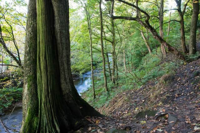
Tarmac and unmade woodland fields and footpaths which may be muddy during winter or when wet.
Location:
Ripponden, Sowerby Bridge
Distance:
1.6 miles
Access:
Ripponden is about five miles south-west of Halifax. Take the A58 from Halifax to Sowerby Bridge and then continue on A58 to Ripponden. The Parish Church is the starting point for this walk. With its tall spire the church is easily visible from most points in the village. There is ample parking in the two car parks nearby on Royd Lane and Mill Fold.
Advertisement
Hide AdAdvertisement
Hide AdWith the church gates behind you and the Old Packhorse Bridge on your right, join a small lane which dives down under the B6113 road bridge.
Follow this road beyond the bridge, passing the former Ripponden Mill on the right and a playground.
The lane leads to a small park where you need to bear right following the surfaced path which soon veers left to a surfaced access road going ahead.
Bear slightly right onto this with the river to the right follow it past all the buildings on the left.
Beyond the buildings there are two fields to the left.
Advertisement
Hide AdAdvertisement
Hide AdHalfway along the side of the second field the tarmac surface goes slightly leftwards towards two houses.
Bear right off the tarmac and onto a wooded riverside path.
Follow this path to the end of the footbridge.
Turn left up the steps just after the bridge and continue forward walking parallel to the river.
Pass a pair of signposts and continue straight ahead with the river on your right. Please take care where the footpath rises away from the river.
Continue to the point where the river and path do a turn to the left.
This is where the Booth Dean Beck joins the Ryburn.
Advertisement
Hide AdAdvertisement
Hide AdFollow the path to the left for 30 yards where you will join a surfaced road with an old mill on the right.
Cross over the road onto an unsurfaced lane (still alongside the river). After 100 yards you will come to a junction.
Turn left here on the surfaced lane but resist any temptations to bear leftwards through gaps in the boundary as you ascend.
As the lane eases in gradient, the surfaced route turns off to the right.
Advertisement
Hide AdAdvertisement
Hide AdContinue straight ahead to a T-junction of lanes on higher ground.
Turn left and follow the path along the level section, continuing as it starts to rise again gently.
The wall turns left at a signpost, go left here down some steps (please take care when wet as this section may become slippy underfoot).
You will soon come to a bridge over a former railway line.
At the bottom of the steps take the path to the right, following the route of the old railway line as far as the first bridge.
Advertisement
Hide AdAdvertisement
Hide AdImmediately after the bridge there are some steps on the left.
Go up these as the path continues on the top of the cutting which looks out over the River Ryburn.
Keep straight ahead to the next old bridge where there’s a gap in the left-hand corner.
Beyond this is a narrow lane leading downhill to the B6113 again with the Parish Church easily visible.