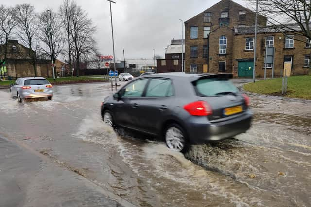
Storm Franklin: Flood warnings remain in place for these areas in Calderdale
and live on Freeview channel 276
The Environment Agency has issued flood warnings for parts of the borough. Here is rundown of the areas that residents and businesses need to take action.
Hebble Brook at Halifax
River levels remain high as a result of persistent (heavy) rainfall, but are beginning to fall. Consequently, the risk of flooding remains.

Advertisement
Hide AdAdvertisement
Hide AdAreas most at risk are properties at Dean Clough Industrial Park and Dean Clough Mill. River levels are falling, but further rain is forecast throughout today. Consequently, the risk of flooding remains. The EA is closely monitoring the situation and its incident response staff are closely monitoring the forecast.
People should avoid using low lying footpaths near local watercourses and plan driving routes to avoid low lying roads near rivers, which may be flooded.
River Calder at Brearley and Luddenden Foot
River levels are continuing to fall on the River Calder at Brearley and Luddenden Foot.
No further significant rainfall is forecast in the next 24 hours and the EA expect to be able to remove this warning later today.
Advertisement
Hide AdAdvertisement
Hide AdIts incident response staff are closely monitoring the forecast on a 24 hour basis.
People should avoid using low lying footpaths near local watercourses and plan driving routes to avoid low lying roads near rivers, which may be flooded.
River Calder at Central Todmorden
River levels have risen rapidly as a result of persistent heavy rainfall. Consequently, flooding of property is imminent.
Areas most at risk are central Todmorden. Further rainfall is forecast over the next 12 hours.
Advertisement
Hide AdAdvertisement
Hide AdThe EA incident response staff are closely monitoring the forecast. People are being told to plan driving routes to avoid low lying roads near rivers, which may be flooded
River Calder at Todmorden from the Cricket Ground to the Railway Bridge
River levels have risen rapidly as a result of persistent heavy rainfall. Consequently, flooding of property is imminent. Areas most at risk are properties in the area between the Cricket Ground and the railway bridge. Further rainfall is forecast over the next 12 hours.
Walsden Water at Walsden
River levels are continuing to fall on the Calder at Walsden. No further significant rainfall is forecast in the next 24 hours and the EA expect to be able to remove this warning later today.
Flood alert - Lower River Calder catchment
Advertisement
Hide AdAdvertisement
Hide AdRiver levels have risen as a result of persistent (heavy) rainfall overnight and this morning.
Due to the saturated conditions and thawing of any lying snow, river levels are likely to be particularly high throughout today, remaining high overnight and into Monday
Areas most at risk initially are low lying land and roads. Please avoid using low lying footpaths near local watercourses and plan driving routes to avoid low lying roads near rivers, which may be flooded.
Comment Guidelines
National World encourages reader discussion on our stories. User feedback, insights and back-and-forth exchanges add a rich layer of context to reporting. Please review our Community Guidelines before commenting.